California Pocket Maps 6.3
Continue to app
Free Version
Publisher Description
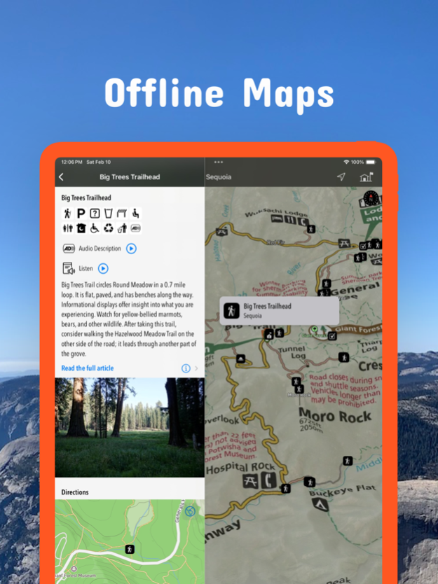
Early Spring 2024: Be prepared for your adventure without Wi-Fi or mobile service! Download California maps for national parks, monuments and state parks before you hike.
Be prepared! Plan your next trip to one of the great California parks. Download maps and guides before you venture into the Wi-Fi free wilderness.
Discover
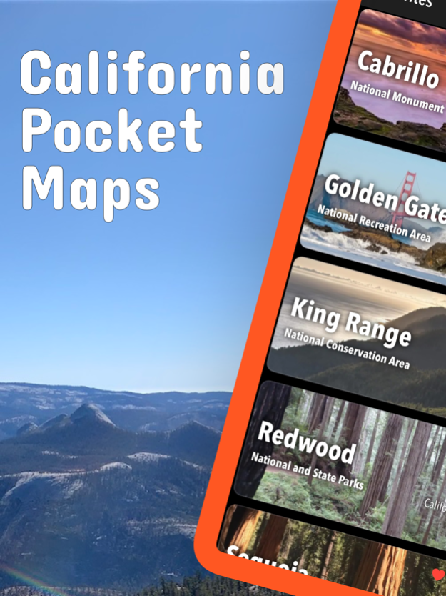
- 400+ national parks, state parks, monuments, forests
- 340+ neatly folded maps by the National Park Service, Bureau of Land Management, United States Forest Services, and other agencies.
- Motor Vehicle Use Maps (MVUM), Motor Vehicle Travel Maps (MVTM) and visitor maps for California national forests.
- 5,000+ campgrounds and campsites
- 6,200+ trails and trailheads
- 140,000+ points of interests
Plan
- Download maps, park brochures, and newspapers. These downloads are ready when you are offline and off the grid in the great outdoors.
- Download arbitrary map sections as offline packs.
- Photo galleries, panorama views.
- Share links to parks and maps with friends
Have fun
- GPS and GPX support: record your hikes, import GPX routes, tracks and waypoints for your hiking trails.
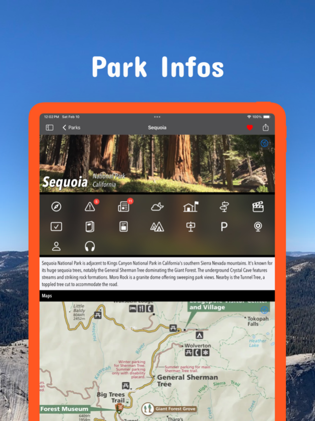
- Detailed national park information: alerts, news, visitor centers, campgrounds, driving directions, weather.
- Open your favorite maps app to get a route to the selected park.
- Current weather conditions, easy access to multi-day forecasts, sunrise and sunset times.
- Push notifications for park alerts, park news, weather warnings
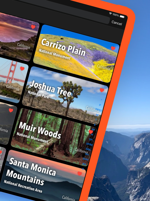
So download maps and guides for:
Angeles
Anza-Borrego Desert
Berryessa Snow Mountain
Bizz Johnson
Cabrillo
California Costal - Point Arena - Stornetta Unit
Carrizo Plain
César E. Chávez
Channel Islands
Cleveland
Cow Mountain
Death Valley
Devils Postpile
East Bay Regional Parks
Eldorado
Fort Ord
Fort Sage
Golden Gate
Headwaters
Humboldt-Toiyabe
Inyo
Joshua Tree
Keysville
King Range
Kings Canyon
Klamath
Lake Tahoe
Lassen
Lassen Volcanic
Lava Beds
Los Padres
Mammoth Lakes
Manzanar
Mendocino
Midpeninsula Regional Open Space
Mojave
Mojave Trails
Nobles Emigrant Trail
Piedras Blancas Light Station
Pinnacles
Plumas
Point Reys
Presidio of San Francisco
Redwood
Rice Canyon
San Bernadino Mountains
San Francisco Maritime
San Gabriel Mountains
Sand to Snow
Santa Clara County Parks
Santa Monica Mountains
Santa Rosa and San Jacinto Mountains
Sequoia
Sierra
Six Rivers
Tahoe
Whiskeytown
Yosemite
There are additional useful information and brochures for many California state parks.
- FULL ACCESS is available for a for $3.49/three month (after a free 3-days trial period) or $2.49/two months or $7.49/year. You can subscribe and pay through your iTunes account. The account will be charged for renewal within 24-hours prior to the end of the current period, and identify the cost of the renewal. Your subscription will automatically renew unless canceled at least 24 hours before the end of the current period. Auto-renew can be turned off anytime by going to your Account Settings in iTunes after purchase.
- Continued use of GPS running in the background can dramatically decrease battery life.
LEGAL
Terms of Use: https://www.icoat.de/pocketmaps/terms
Privacy Policy: https://www.icoat.de/pocketmaps/privacy
Mar 25, 2024
Version 6.3
Early Spring 2024
Updates: Sierra Azul, Teague Hill, Uvas Canyon, Joseph D. Grant, Tri-Forest Snowmobile Trails, Stanislaus National Forest Fire maps, Arnold Rim Trail, Yosemite
Updates: Contains the latest data by the National Park Service (NPS), Bureau of Land Management (BLM), United States Forest Service (USFS) and recreation.gov.
About California Pocket Maps
California Pocket Maps is a free app for iOS published in the Recreation list of apps, part of Home & Hobby.
The company that develops California Pocket Maps is Alex Gugel. The latest version released by its developer is 6.3.
To install California Pocket Maps on your iOS device, just click the green Continue To App button above to start the installation process. The app is listed on our website since 2024-03-25 and was downloaded 0 times. We have already checked if the download link is safe, however for your own protection we recommend that you scan the downloaded app with your antivirus. Your antivirus may detect the California Pocket Maps as malware if the download link is broken.
How to install California Pocket Maps on your iOS device:
- Click on the Continue To App button on our website. This will redirect you to the App Store.
- Once the California Pocket Maps is shown in the iTunes listing of your iOS device, you can start its download and installation. Tap on the GET button to the right of the app to start downloading it.
- If you are not logged-in the iOS appstore app, you'll be prompted for your your Apple ID and/or password.
- After California Pocket Maps is downloaded, you'll see an INSTALL button to the right. Tap on it to start the actual installation of the iOS app.
- Once installation is finished you can tap on the OPEN button to start it. Its icon will also be added to your device home screen.
